Urban Expansion
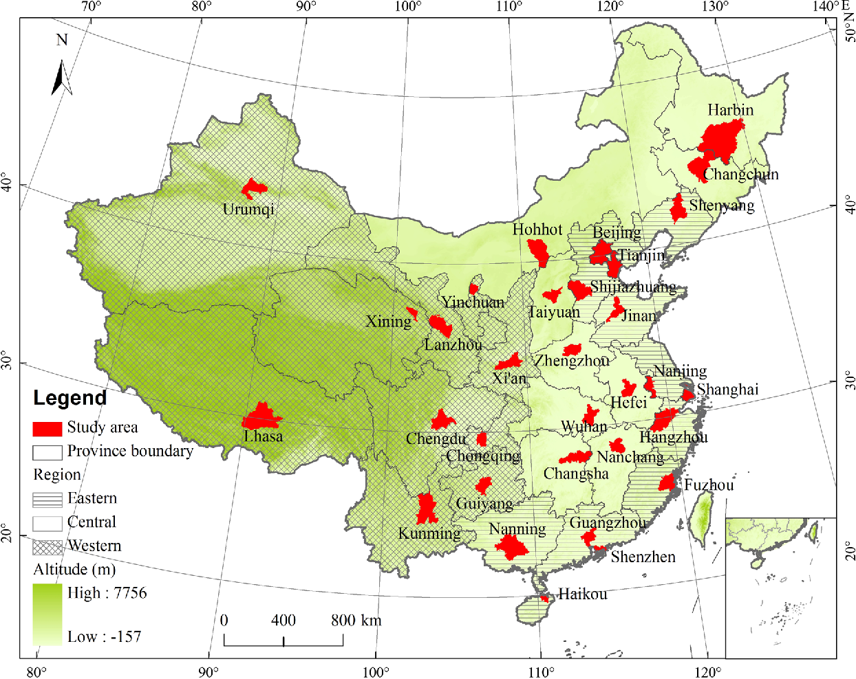
We presented an effort at the national level to map and quantify the rates, spatial patterns, and temporal courses of urban expansion in China from 1978 to 2010. We found the total urban extent of 32 major cities increased exponentially with an average rate of 6.8% from 1978 to 2010, and smaller cities had higher expansion rates than larger ones in general. China’s urbanization process has demonstrated unexpected major shifts since 2005: the overall urban expansion rate increased drastically as the mean time for doubling city size reduced half from 14.6~20.4 (prior to 2005) years to 9.7 years; the variability of the expansion rates across cities had narrowed down dramatically with no apparent differences among large and small and across regions.
Urban Heat Island Effects
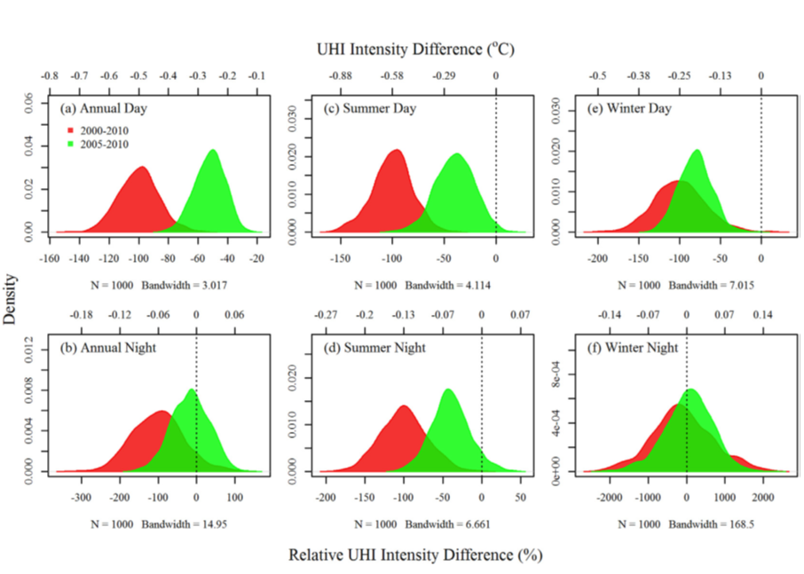
It is critical to use concurrent urban extent and LST maps to estimate UHI, which demands mapping land surface conditions accurately and timely. We mapped and quantified the diurnal and seasonal surface UHI intensity (SUHII) for Chinese 32 cities, and analyzed their spatial variations and possible underlying mechanisms. SUHII showed distinct diurnal and seasonal spatial patterns with varying drivers in China. Climate was the dominant control on cross-city SUHII variability. The footprint of UHI effect (FP, including urban area) was 2.3 and 3.9 times of urban size for the day and night, respectively, with large spatiotemporal heterogeneities.
Urbanization Effects on Vegetation
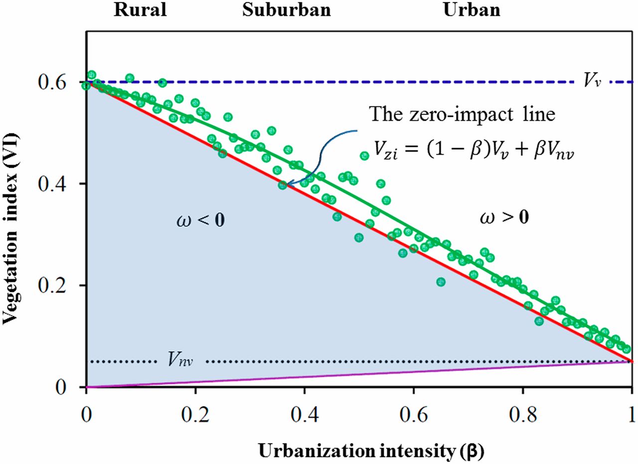
Cities experiencing elevated temperature, CO2, and nitrogen deposition decades ahead of the projected average global change. It is for this reason that cities have been regarded as ideal natural laboratories for global change studies and particularly valuable to elucidate the potential responses of other nonurban ecosystems to future climate and environmental changes. We developed a general conceptual framework for quantifying the impacts of urbanization on vegetation growth and applied it in 32 Chinese cities and 377 metropolitan statistical areas in the conterminous United States. Prevalent vegetation growth enhancement exists in urban Environments. The growing season started earlier and ended later in urban zones compared to rural counterparts.
Evolution of Chinese Cities
Understanding how cities evolve temporally, spatially, and organizationally in a rapidly urbanizing world is critical for sustainable development. Our studies show the temporal co-evolution of multiple physical, demographic, socioeconomic, and environmental attributes in individual cities, and the cross-city scaling of urban attributes at six time points in 32 major Chinese cities. The results demonstrate a diseconomy of scale in urban areal expansion that indicates a significant waste of land resources in the urbanization process. Future planning efforts should focus on policies that increase urban land use efficiency before continuing expansion.

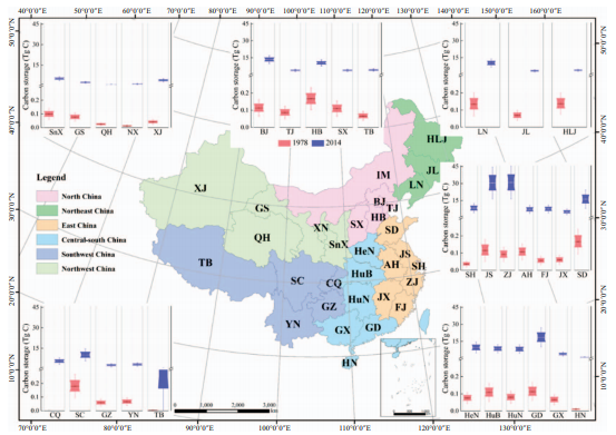
Carbon in cities
Contemporary urbanization has profound impacts on the biogeochemical cycles of the Earth system, both within cities and far beyond their boundaries. Rigorously quantifying carbon flows and stocks in urban ecosystems is becoming increasingly important to ensure the completeness and accuracy of carbon cycle research and reporting at regional to global scales.
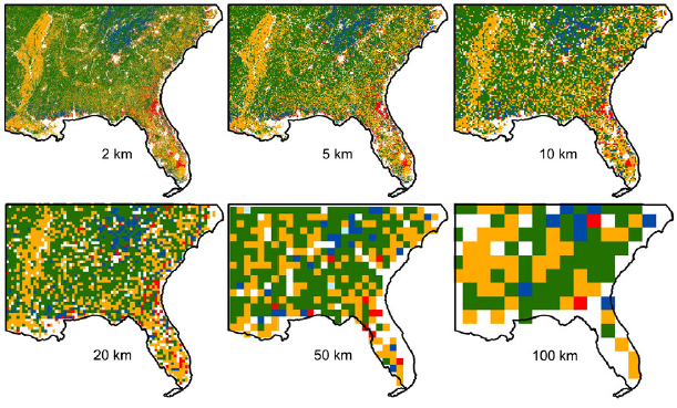
Scale Criticality
Scaling is central to ecology and Earth system sciences. However, the importance of scale (i.e. resolution and extent) for understanding carbon dynamics across scales is poorly understood and quantified. We simulated carbon dynamics under a wide range of combinations of resolution and extent, in the southeastern United States to explore the existence of scale dependence of the simulated regional carbon balance.